About Alonissos

Alonissos, or 'Ikos' and 'Liadromia' in ancient times, is the third largest island in the Northern Sporades archipelago. It belongs to the prefecture of Magnesia, is 4,5 km wide at its widest and 20 km at its longest and covers a total area of 64,5 square kilometers. The island can be described as of hilly landscape with a rather low altitude, with the highest peak (locally known as 'Kouvouli') reaching about 475m. Its population reaches approximately 2,700 inhabitants. The main settlement and port of the island is Patitiri, while other important settlements are located in Votsi, Steni Vala and the Old Village or 'Chora', which was the main town of the island before being abandoned after a 1965 earthquake. Alonissos has a very long history, dating back to the Paleolithic period when it was first inhabited. The economy of the island is currently based on agriculture, livestock, fishing and tourism. Due to its unique landscape and geographical position, the island has a rich biodiversity, with several endemic and endangered species. It is covered by very diverse vegetation with aleppo pine forests, maquis and phrygana scrublands, evergreen oak forests and olive groves. The island is also part of the National Marine Park of Alonissos (N.M.P.A.N.S.), the largest marine protected area in Greece, and of the GR1430004 zone of Natura 2000.

Patitiri town and harbor

Steni Vala

Typical sight at Chora

Sheep at Isomata

View towards Votsi 

Landscape at Koumarorahi

The northern coast

Fishing boat near Mourtias

Vythisma beach

Cliffs at the north side of Kouvouli

Agioi Anargyroi

Geomorphology of Alonissos

Alonissos is the third largest island in the Northern Sporades archipelago. The island is dominated by limestone throughout its whole extent, with upper quaternary lake deposits at the SW part. It is of generally hilly landscape and has a relatively low elevation, reaching about 475 m asl at Kouvouli Mt. Other significant peaks are Geladias (449 m), Xiropefko (400 m), Serafeim (388 m), Galanou Rachi (346 m), Tourkovigla (340 m), Frouros (331 m), Kalovoulos (325 m), Vouno (260 m) and Strovili (255 m), which together with the hills of Skopelos form a perpetual mountain range. 

Apart from hills, the geology of the island is also comprised by gorges, steep cliffs ending abruptly into the sea, caves, bays, small capes and lowlands (especially at the SW part). Numerous offshore rocky islets also surround the island, such as Manolas off the northern coast and Kokkinonisi off  the southern coast. 

View from the foothills of Vouno towards the northern coast

View towards the hills at the central part of the island, including Tourkovigla on the right

View from Serafeim hill towards Kouvouli and the plain of Gerakas

View from Koumarorahi hill towards Agios Dimitrios and Peristera

View from the top of Kalovoulos, Manolas islet can be seen

Manolas and the smaller Stavros islet


Agios Dimitrios lagoon | Biotopes

The lagoon of Agios Dimitrios is the only natural wetland on Alonissos. It is located 13 km from Patitiri town, next to the beach of Agios Dimitrios. It covers an area of 8,53 km2 and is seasonal, usually holding rainwater between early winter and May or June, sometimes even July, depending on the amounts of rainfall. The vegetation consists of Mediterranean salt meadow plants, with Juncus sp., Sporolobus pungens and Salicornia sp., as well as a zone of dense shrubland with Brambles Rubus sanctus and Mastic Trees Pistacia lentiscus. The lagoon is of major ecological and aesthetic importance and is protected by the Presidential Decree regarding small wetlands of Greek islands (ΦΕΚ229/ΑΑΠ/2012). It is a very important stopover for migratory birds, such as waders, herons, ducks, moorhens and passerines. The great diversity of orchids and odonata in the area should also be noted.

The lagoon as seen from the nearby hills

Squacco heron Ardeola ralloides

Wood sandpiper Tringa glareola

Little Egret Egretta garzetta

Spotted redshank Tringa erythropus

Educational sign at the lagoon

Bee orchid Ophrys sicula

Pyramidal orchid Anacamptis pyramidalis

Kastanorema water dam | Biotopes

The water dam of Kastanorema was constructed in the late 2000's to early 2010's for purposes surrounding concentration of freshwater from the streams ending up at the valley of Kastanorema, but for technical reasons was never operated. Covering an area of approximately 150 km2, it has year-round presence of freshwater and is covered by large stones and little aquatic vegetation, mainly consisting of Pondweed Potamogeton sp. and grasses. The valley of Kastanorema is located at the river mouth of Kastanorema gorge, where a small perennial stream flows. The area is covered by dense maquis, oak forests and some olive groves and is located at the NE part of Alonissos, 14 km from the main town of Patitiri. The dam is an important stopover for migratory avifauna and is also a hotspot for birds of prey, such as kestrels, falcons, buzzards and owls. The valley is also an important nesting area for several passerines. Dragonflies, butterflies and dozens of interesting flowering plant species thrive in the area.

View of the water dam

The Kastanorema stream

Eleonora's falcon Falco eleonorae

Erhad's wall lizard Podarcis erhardii

Behind the dam

View of Kastanorema valley 

Northern Wheatear Oenanthe oenanthe

Crocus nivalis

Vegetation of Alonissos

The vegetation of the island is similar to the rest of the Northern Sporades islands. Due to geographic position and climate, Alonissos has a wide variety of vegetation zones, forming shrublands, forests and meadows of different species composition. Human presence (agriculture, animal grazing, etc) also plays an important role in shaping the vegetation zones of the island, with the widespread olive groves and vineyards being excellent examples. In general, we distinguish 6 main vegetation zones on Alonissos. Due to short-term variations, however, these zones are not entirely distinct.

Mediterranean Aleppo Pine Forests

The most widespread forest type on Alonissos is formed by Aleppo Pine (Pinus halepensis), occupying large areas at the south-western and central parts of the island. Pine forests occur from sea level to approximately 350 m asl. They begin as particularly intense at the westernmost parts, slowly fading at the central part of the island, before being replaced by other habitat types. The shrub layer of pine forests is very often covered by dense maquis or ferns, depending on local humidity.

Pine forest

Pine forest

Pine forest

Hills covered by pine forests

Oak Forests

Forests formed by Holm Oak (Quercus spp.) dominate the higher elevations of central and north-eastern Alonissos. They are usually closed, low canopy forests, often bordered by open shrublands. They are present from sea level to 450 m asl, although they are mostly typical of altitudes above 300 m asl. Their lower layers are usually under heavy grazing by goats. Other trees are commonly present as single stands within holm oak forests, such as Cretan Maple (Acer sempervirens).

Oak forest
Oak forest

Oak forest

Thermo-Mediterranean Maquis

Perhaps the most common vegetation type present throughout the island. Thermoxeric maquis is composed by a large list of evergreen shrub species, with the most typical examples being Mastic Trees (Pistacia lentiscus), Kermes Oak (Quercus coccifera), Strawberry Trees (Arbutus spp.), Carob Trees (Ceratonia siliqua), Olive Trees (Olea europaea), Common Myrtle (Myrtus communis), Green Olive Trees (Phillyrea latifolia), Phoenicean Juniper (Juniperus phoenicea), Heath (Erica spp.), Bay Trees (Laurus nobilis) and others. Dense maquis covers most of the island's surface, from sea level to approximately 450 m asl.

Maquis

Maquis

Maquis

Hillsides covered by maquis

Phrygana

Phrygana are the east-mediterranean version of garrigue and are characterized by low thermoxeric shrublands consisting of thorny shrubs and other low flowering plants. Although they occur throughout the whole island, they are mainly typical of the more arid areas, such as rocky shores, beaches, hillsides, small offshore islets, as well as the higher elevations (above 450 m asl.). The most characteristic species composing phrygana are Thorny Bournets (Sarcopoterium spinosum), Spiny Spurges (Euphorbia acanthothamnos),  Jerusalem Sage (Phlomis fruticosa), Conehead Thyme (Thymus capitatus), Spiny Broom (Callicotome villosa), Greek Sage (Salvia fruticosa), Rock Rose (Cistus spp.) and several others.

Phrygana in an olive grove

Rock rose Cistus creticus

Thorny Bournet Sarcopoterium spinosum
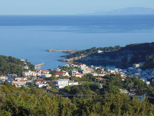
Cultivated land

On Alonissos, cultivations mainly consist of orchards and vineyards. Olive groves cover a considerable area of the island's surface, stretching all the way from the westernmost, to the easternmost parts of the island. They are present as large cultivated orchards or smaller olive tree stands within other types of vegetation and are largely used for oil production. Vineyards are mainly present near settlements, especially at south-western Alonissos. Other common cultivated tree species are Fig Trees, Orange Trees, Pear Trees, Apricot Trees and Almond Trees, which are usually limited to individual trees rather than whole orchards. Cultivated areas are often mixed with riparian vegetation.

Cultivated land with olive groves and vineyards

Agricultural area

Olive groves

Olive groves 

Agricultural area

Riparian zone and Mediterranean salt meadows 

Hydrophilic plants form dense riparian vegetation around water sources, especially intermittent streams and river beds. These zones are often found within cultivated areas, pine forests or maquis and are characterized by plants like Reeds, Ferns and dense shrublands of species like Brambles (Rubus sanctus). In addition, meditteranean salt meadows formed by wetland species such as Sand Dropseed (Sporolobus pungens) and Rushes (Juncus spp.) exist at the seasonal lagoon of Agios Dimitrios. 

Reeds

Ferns and Brambles Rubus sanctus

Agios Dimitrios lagoon

About

About Alonissos

Alonissos, or 'Ikos' and 'Liadromia' in ancient times, is the third largest island in the Northern Sporades archipelago. It ...